No cutesy lead-in, just the unadorned fact that I completed Pittsburgh’s legendary, epic, ridiculously evil Dirty Dozen ride. And it was awesome!
This blogpost starts out with the high-level whys and hows, followed by a lot detail about the ride and each of the thirteen hills, and ends with my advice, hints, and tips for anyone considering riding the Dirty Dozen. Along with a chunder of photos and links to numerous videos.
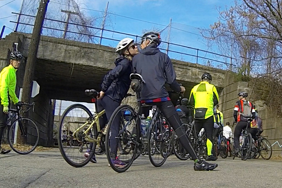
 Two riders share a kiss while waiting for a train to pass before climbing Hill 5 (Logan). |
 Weaving back and forth across Hill 5 (Logan), this rider nearly took me out. |
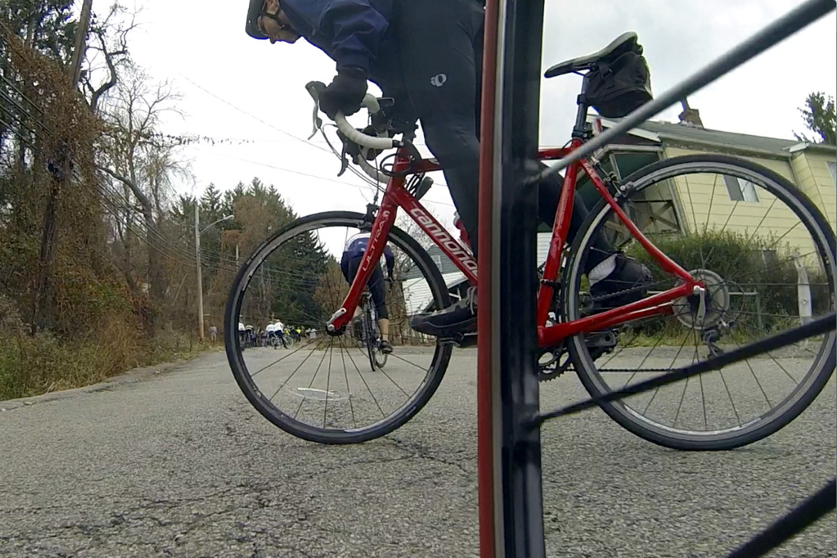
 Ornoth descending Hill 6 (Rialto) from the neighborhood of Troy Hill. |
 Video of Ornoth (around 0:16) rolling up Hill 6 (Rialto). |
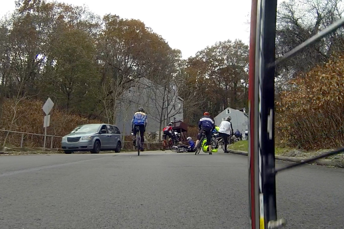
 Two riders hit the deck and two others are stopped early on Hill 7 (Suffolk). |
 Video of Ornoth (in black) amongst a group of riders (around 3:02) to the top of Suffolk St. |
 Group 3 after Hill 8 (Sycamore), with helmet-less Ornoth left of center, looking down. |
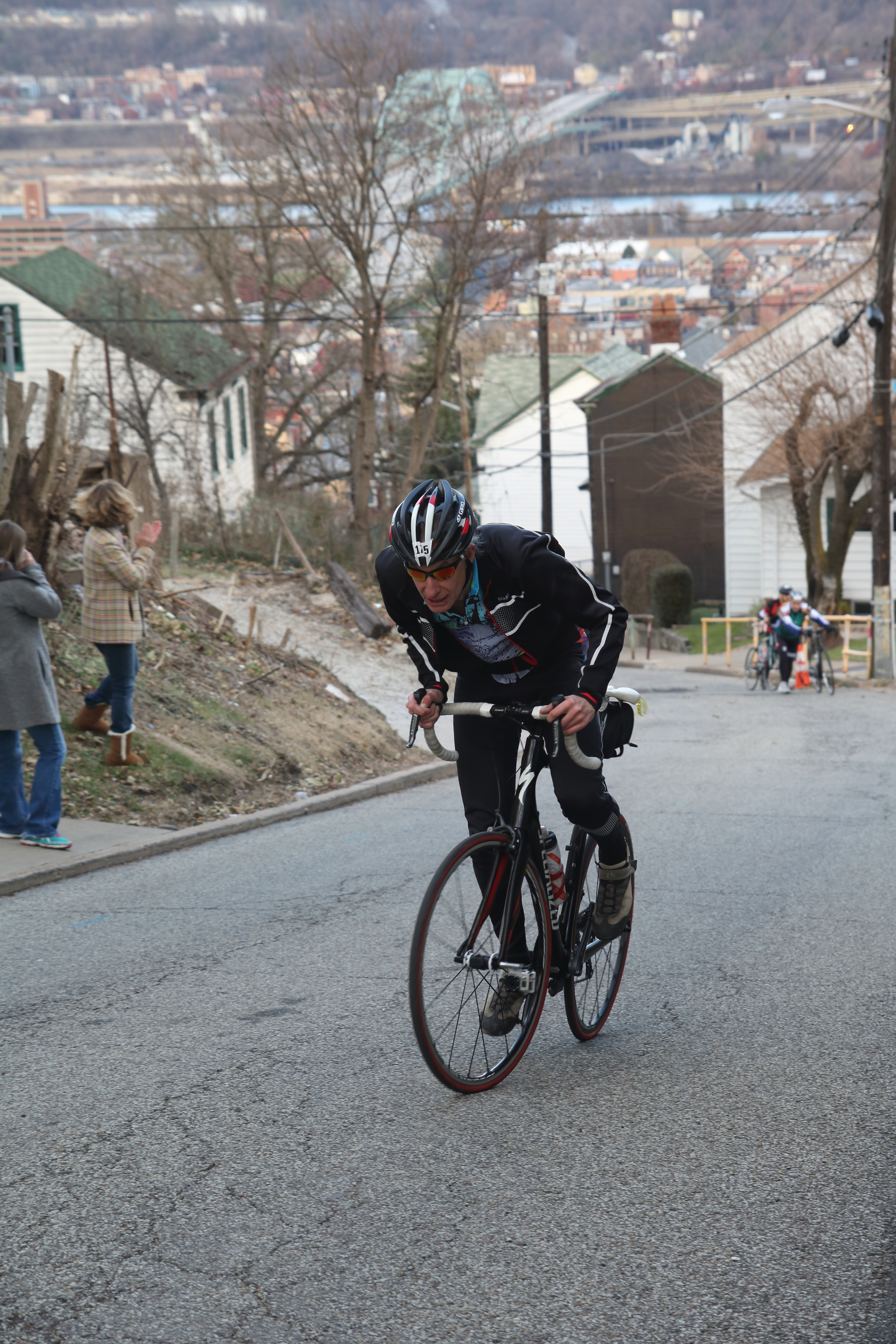
 Great closeup action shot of Ornoth ascending Hill 9 (Canton Ave). |
 Video of Ornoth tackling the lower half of Canton Ave (from 2:43 onward). |
 Video of Ornoth conquering the upper half of Canton Ave (10:50 to 11:00). |
 Video of my Canton Ave ascent taken from my front wheel. Camera vibration warning! |
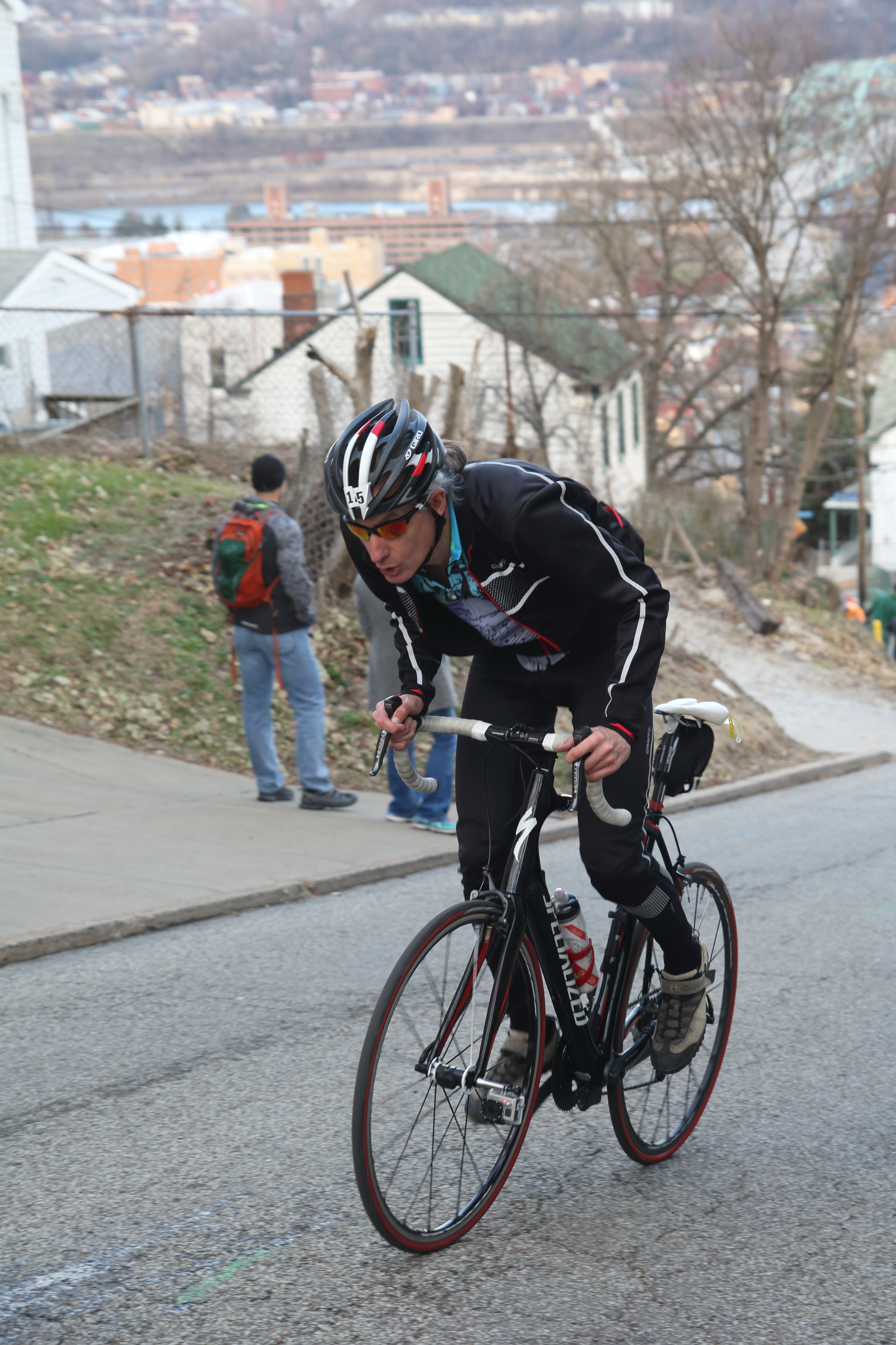
 Ornoth on the final ramp of Hill 12 (Eleanor) with the Birmingham Bridge in the background. |
 Ornoth still climbing that final ramp of Hill 12 (Eleanor). |
 Gasping for air, just rolling over the top of Hill 12 (Eleanor). |
 This is on the flat bit (Flowers Ave) at the start of the final climb. My shadow appears more eager than I am to face Hill 13 (Tesla). |
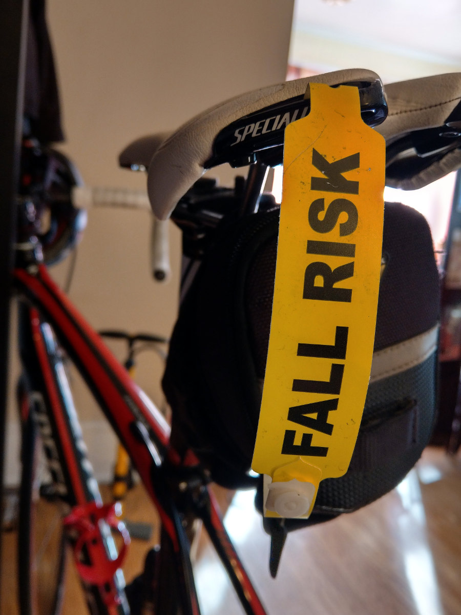
 The yellow hospital FALL RISK wristband I hung from my saddle... Very appropriate for the Dirty Dozen! |
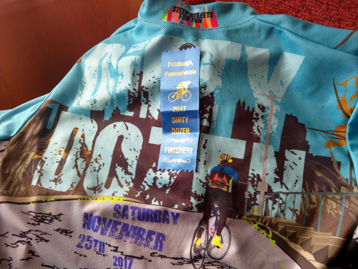
 My 2017 Dirty Dozen jersey and that precious, hard-won official finisher's blue ribbon! |
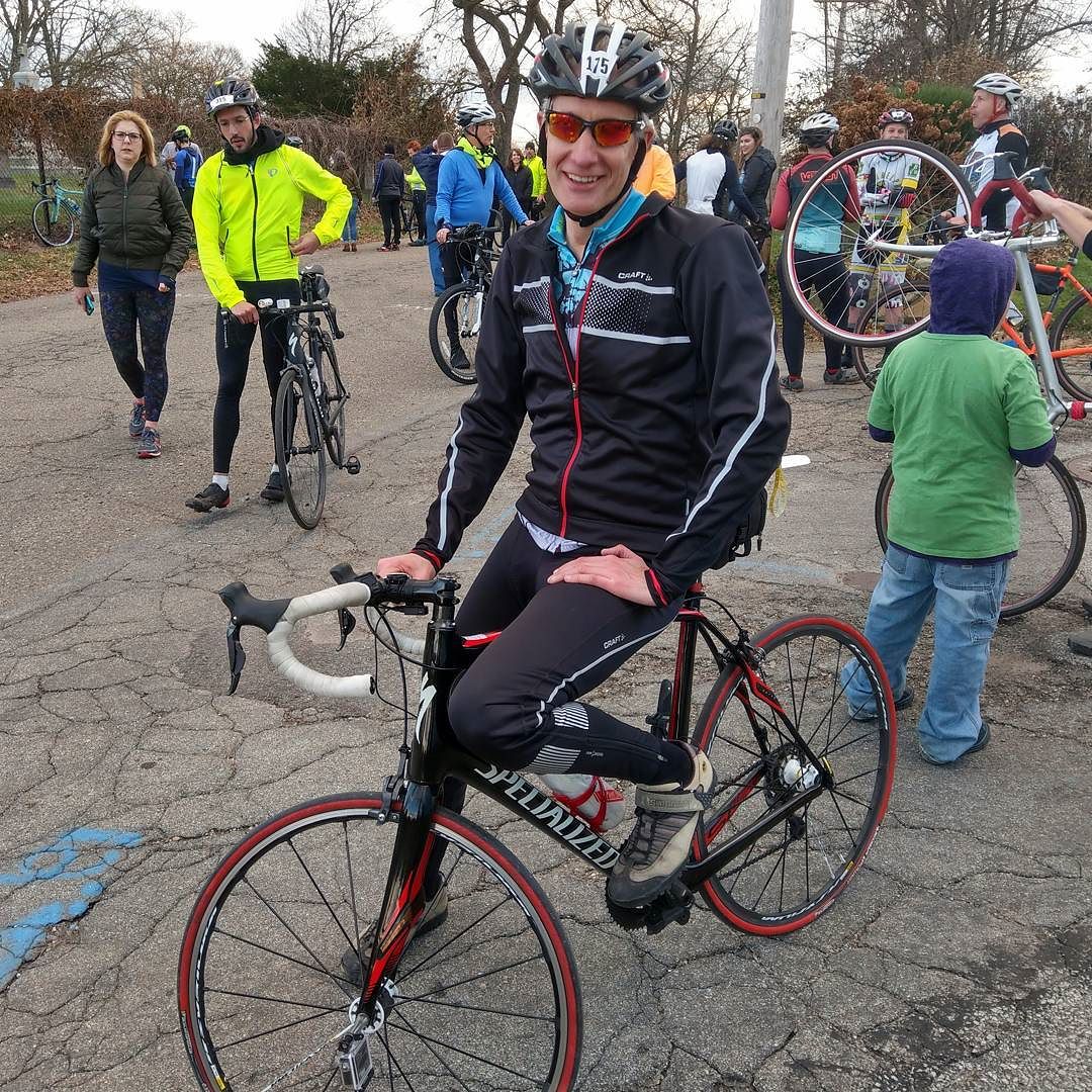
 The tired-but-happy look of an official Dirty Dozen finisher! |
What is it?
Spend the Saturday after Thanksgiving riding your bike up the traditional thirteen steepest hills in Pittsburgh. None are less than 20% max incline, some are over 30%, and at 37% Canton Ave is the steepest street on the entire planet! I am talking absolutely out-of-your-skull ludicrous amounts of pain.
Uhh, that sounds stupid. Why do it?
Each rider has their own motivations, but it usually boils down to the obvious: it’s a remarkable challenge. Do you have the muscle strength to survive the unforgiving length of Suffolk? Do you have the technical skill needed to ride up Canton without falling off the planet? Do you have the mental strength to look at a wall like Berryhill or Boustead and not give up and cry? And do your legs have the endurance to ride thirteen of these unforgiving bastards back-to-back? And can you do all that on cold, blustery day in late November?
Because it’s such a ridiculously extreme challenge, finishers earn lifetime bragging rights and respect. It’s a unique ride you can only do here in Pittsburgh. And between the cheering crowds and the camaraderie of other riders, it’s a whole lot of fun.
The race—yes, it actually is a race, if only for an inhumanly strong few—drew my attention long before I thought about moving to Pittsburgh. Since I was regularly here to visit Inna, years ago I checked out the local bike scene and discovered the event, even watching the live video feed streamed over the internet for several years.
When I moved here two years ago, I missed the 2015 event by just four days. Even if I was in no condition to ride, I would have enjoyed spectating and playing photographer.
Once here, I resolved to ride in 2016, and my resolve was doubled that spring, after the event’s colorful founder—two-time Race Across America winner Danny Chew—was crippled in a bike crash. I registered, scouted out eleven of the thirteen hills, riding them for a combined total of 21 ascents, and participated in the first of seven preparatory group rides…
Then my mother was hospitalized and I spent the next five months in Maine, missing the ride and resignedly watching the live video feed for another year. I consoled myself by creating a tool to compare the steepness of multiple road segments, including the Dirty Dozen hills.
How did I prepare?
This being my first attempt, and knowing I wouldn’t be racing for points, I took a step back and considered what my goals were. At the most basic, I wanted to have fun and to learn a lot. But my stretch goal was to become an “official” finisher, completing all thirteen hills without crashing, stopping, dabbing, or losing uphill progress.
You do not want to go into the Dirty Dozen without training for the rigors of climbing steep hills. My strategy, as with every ride I do, was: train by doing the same kind of riding you expect to encounter in the event. And with eleven of the thirteen Dirty Dozen hills within striking distance, the plan was obvious: climb those goddamned hills!
For eight weeks preceding the race, I spent one midweek day doing solo rides of the hills, both to build up my strength as well as to recon the hills themselves, learning where they were hardest and where I could back off and conserve my strength.
Then, each weekend I would join the weekly group training rides organized by the Western PA Wheelmen. Those started out doing 3-4 hills at a time, graduated to doing 6-7 at a time, and culminated by riding the entire course two weeks before the event, leaving ample time for recovery before race day.
As early as the second group ride I was joining others for “extra credit”, doing an additional four hills for a total of eight at a time. That gave me a lot of confidence that my body could withstand an entire day of hills. My self-assurance grew further when I successfully completed the group ride that covered the first seven hills in the rain!
As I described in my pre-ride blogpost, the final, full-course training ride was a brutally cold 17° ride, and I was disappointed by having to dab no less than four times for various reasons, including insufficient strength to finish off the last two hills.
When the training rides were done, I’d ridden every hill at least three times, some a dozen times, with a combined total of 75 ascents. I was as well prepared as possible. I was pretty confident, except for the difficulties I’d had on that last training ride. And I was really scared.
Although the forecast had called for temps rising from 38 to 50° with 30% chance of rain, I woke up to a pleasant surprise Saturday morning: clear skies and a temperature of 48°, heading toward the mid-50s! I donned my new 2017 Dirty Dozen jersey underneath my thermal jacket.
I set out at 8:15am and ran into other riders heading in the same direction, including one with my friend Ryan. I overheard them saying it was the best weather in the history of the event!
The Start
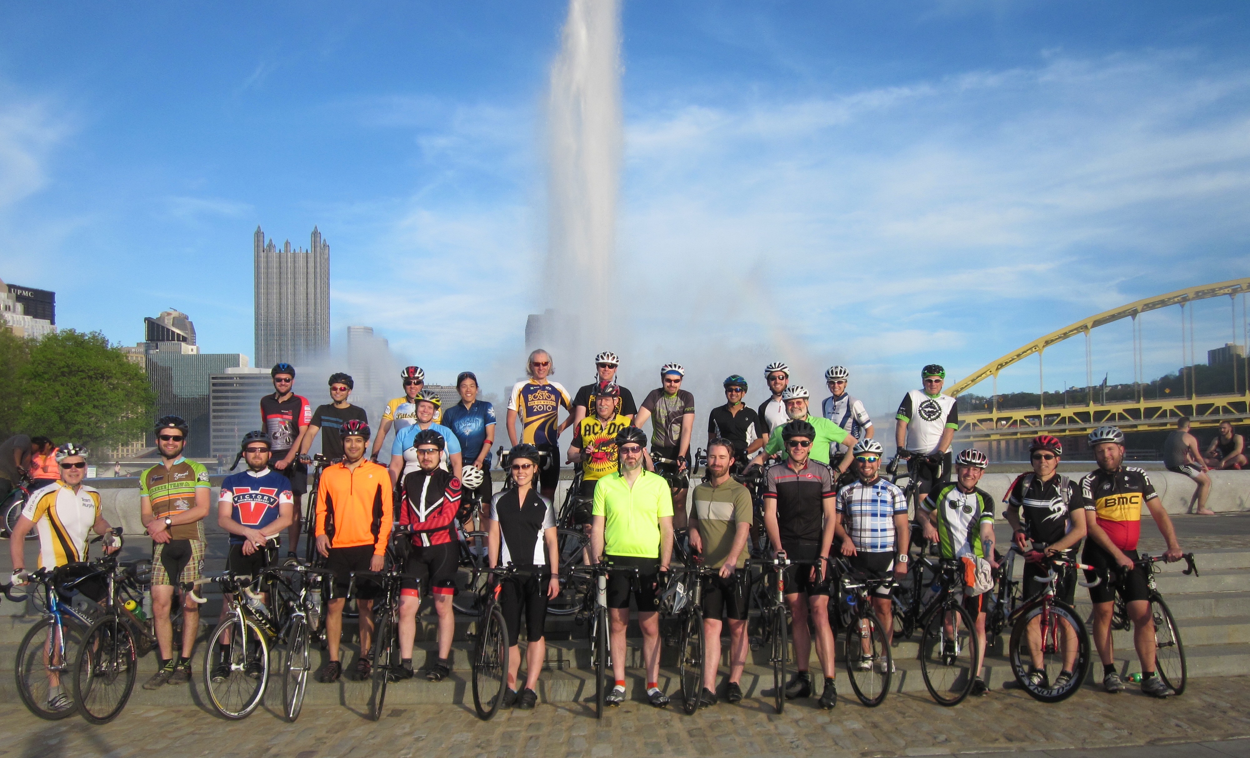
I swooped into the Bud Harris bike track at 8:30 and was greeted by friends Stef and Jim directing traffic. Stef had come back for the event from her new home in Vermont. She was going to marshal the fourth of four groups of riders—the “Party Bus”—but said she was sure she’d run into me out on the course. Sorry Stef, I wasn’t about to let that happen!
By 8:45 I was signed in and ready. They’d had a lot of last-minute registrations, and people were saying there were a record 450-500 riders for this 35th Dirty Dozen.
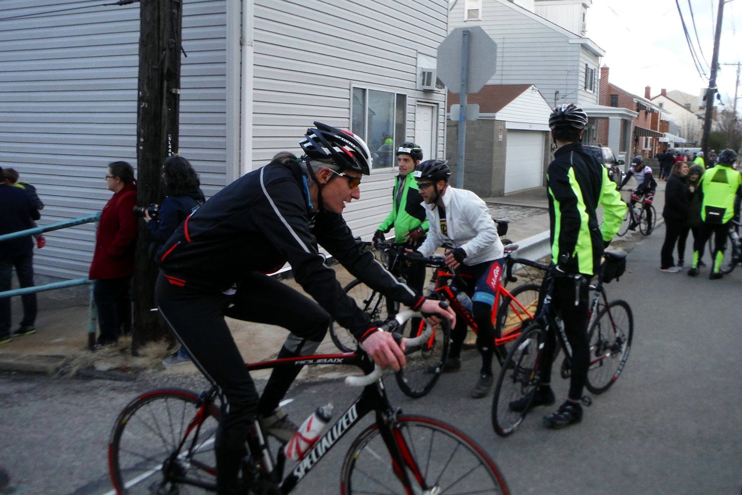
I moseyed over to the track infield and chatted with some training ride buddies, including Jeremiah, who has become famous for riding the event on a ponderous HealthyRide rental bike. We waited for the various groups to line up, which would be released in waves staggered by 5-10 minutes.
The first group were the cyclists racing for points on each hill. The second group were experienced cyclists. I had considered starting in Group 2 and then taking a long rest break halfway through the ride and falling back to a later group, but scrapped that idea when they announced that they were limiting Group 2 to riders below age 40.
So it would be either Group 3 or Group 4. The Group 4 Party Bus is slow and waits for everyone, and is filled with inexperienced riders who are dangerous and have no idea what they’re getting into. Since the danger presented by other riders was my biggest fear, I lined up with Group 3.
At 9:30 my group took the ceremonial lap around the track before hopping onto Washington Boulevard for the neutralized ride across the Highland Park Bridge over the Allegheny River to Aspinwall. Way too soon, we turned into a residential area on the flat along the river. The 2-mile ride barely counted as a warmup before the first hill.
Hill 1: Center Ave, Guyasuta St
Center Ave is just a nice warmup hill. You pass under the Route 28 highway and climb a really steep grade that only rates as middling-steep for the Dirty Dozen. After a quarter mile and 200 feet of climbing, it levels out into a second neighborhood. As you catch your breath, you wonder, “Was that all?”
The answer of course is “no”, but you do get a whopping six blocks of near-flat road to recover before turning onto Guyasuta, which stair-steps another 150 feet over another quarter mile without forcing you to go into the red.
Hill 1 will wake you up and get your legs warmed up. And it does make the first selection, turning back the worst of the tourists and newbies who aren’t ready for the challenge. For the real riders, that big rest in the middle is awfully forgiving, making it one of the easier hills we’d face.
According to Strava, Center/Guyasuta is 0.6 miles, gaining 377 feet in altitude, for an average grade of 11%. In training, I’d ridden Hill 1 four times.
Setting a precedent I would follow all day, I decided to ride at the back of the group. Although the weaker riders would be there, I would at least have the ability to regulate how close I got to them, and I could choose my own pace up each hill. It’s important to remember that your speed doesn’t matter in this race; what matters is that you don’t stop, and that you conserve enough strength to complete all 13 hills.
I eased up Center at a slower pace than I’d done in any of my training rides. Halfway up Guyasuta, I caught up with my riding buddy Phil, who has accompanied me on numerous rides. We finished the hill together, with my time a leisurely 8:01.
Unlike the training rides, where the group enjoyed plenty of recovery time at the top of each hill, we immediately set off for the next. If I had been closer to the front, I would have had more time to rest, but that would have meant taking more risk by riding in the middle of the pack.
One of the implications of climbing the steepest hills in town is that nearly every ascent is followed by an equal—but by definition longer and more gradual—descent. Over the neutralized 4 miles we’d drop 400 feet back down Kittanning Pike to the riverside in Sharpsburg for the next climb.
Hill 2: Ravine St, Midway Dr
If Hill 1 was a nice warmup, Hill 2 proceeds to the next level. Ravine/Midway is a carbon copy of Center/Guyasuta, but without that six-block rest zone in the middle. Another moderate climb, it passes under Route 28, then up a challenging slope, climbing 250 feet over a third of a mile.
The route used to bear left onto Sharps Hill Rd, but now the ride turns right onto Midway, which hairpins back on itself, then—like Guyasuta—climbs another 150 feet over a quarter mile. Strava says Ravine/Midway is also 0.6 miles, rising 404 feet at a 13% grade. Also like Center, I’d ridden it four times in training.
The last time I rode it, two weeks before the race, Midway had been partially milled, and I was concerned about what it might be like on race day. However, it had been freshly paved, which was wonderful.
Again, I paced myself casually to the top, following Phil before eventually passing him. Although I again finished in my slowest time all year (8:19), by the top I was getting kinda sweaty.
Before 2016, from this point the route went out Dorseyville Rd to Hill 3: Berryhill Rd. Although it’s short, it’s the first extremely steep hill, and a real kick in the teeth. Strava would tell you that Berryhill rises 164 feet in just a tenth of a mile at 17%.
You approach Berryhill at the end of a fast descent down Brownshill Rd, and—unlike most other hills—you get a demoralizing full view of its impossible slope rising ahead of you. Many riders are too gobsmacked to downshift before they hit the incline, which causes an immense pileup of riders. Berryhill is the first bloodbath.
Typically, the town of O’Hara closes Berryhill for the season once snow flies; it’s the only Dirty Dozen hill that closes. In 2016, with Danny not in charge, his backup organizers decided to replace Berryhill with a different hill back on the Pittsburgh side of the Allegheny. Needless to say, it wasn’t the same challenge as Berryhill.
Despite warm temperatures and no snow, this year the organizers again opted to forego Berryhill and repeat the 2016 route. For my money, it’s not a real Dirty Dozen without Berryhill. In training for this year, I only rode Berryhill three times, suspecting it might be replaced again.
So after gathering up at the Midway Dr VFD, instead of heading toward Berryhill we rolled up to Kittanning St and down into Etna. From there we took the 62nd St Bridge back over the Allegheny for a brief visit to Lawrenceville, passing Group 2 as they came back across the bridge in the opposite direction. In three miles we approached the alternate version of Hill 3.
Hill 3 (alternate): 57th St, Christopher St
Turning off Butler onto 57th St one starts a gentle 6-8% grade. After a jog onto Christopher, the grade becomes a steady 13%: it’s a hill, but not one where you need to get out of the saddle until a steeper bit at the end.
“Hill 3-B” is three times as long as Berryhill, but lacks the challenging slope. 57th/Christopher climbs 258 feet in a third of a mile (13% average). It’s simply not a Dirty Dozen hill. But having expected the change, I had rode Christopher St five times before the event.
By Hill 3-B I had determined which of the weaker riders posed any danger, so I gave them a wide berth. It was another calm, steady ascent, but my 5:13 wasn’t a new slowest time.
As warm riders regrouped at the top, ride marshal Jason generously offered to carry riders’ discarded layers of clothing in his panniers!
We enjoyed the descent down Stanton and the three miles right back across the 62nd St Bridge, hopping back onto the ride route right at the base of the next climb.
Hill 4: High St, Seavey Rd
Right off the main drag in Etna, High St ramps up to a pretty respectable slope. Then it takes a cambered right turn, followed by switchback reversing to the left onto Seavey. This right-left chicane is the most memorable and challenging feature of Hill 4, and provides a rare—and sometimes demoralizing—opportunity to see other riders just above or below you as you climb the terraced hillside.
After the switchback, Seavey stair-steps, giving you a brief rest before a steep kick to the top. Altogether, High/Seavey is a third of a mile, and gains 224 feet (12%). I also rode High St five times in training.
Because of the view, Hill 4 drew our first sizable crowd of spectators cheering us on. I went wide through the turns, avoiding the steeper inner line, and made it up nicely, despite a headwind blasting me right at the end. Finishing in 4:33, I set another slowest time of the year. I was flawlessly executing my strategy of taking it as easy as possible!
A lumpy three miles brought us down to Millvale Riverfront Park, the first rest stop, at 11:25am. I tucked away my gloves because it was too warm, and I wanted a good grip on the bars for the next section of the route.
After a 25-minute break we rolled out, only to get caught behind a train for 3-4 minutes at a level crossing. A couple blocks later, we were delayed another 3-4 minutes waiting for a garbage truck to come down the hill we wanted to go up. It brought back memories of the 2014 Dirty Dozen, when a belligerent garbage truck driver had blocked the way up Hill 4.
With four hills complete, you might start getting comfortable with the idea of nailing this ride. But the first four hills are nothing more than a friendly warmup, and all conception of “friendly” hills is about to come to a screeching halt.
Hill 5: Logan St
Mere blocks from the rest stop, you’re faced with the steep slope, narrow roadway, and broken pavement of Logan Street. Logan is only a quarter mile, but it climbs a full 244 feet (20% average). The first section through some trees, although steep, doesn’t seem terrible, but the trees part to reveal a veritable wall that ramps up in front of you, and it just keeps getting steeper. This is not a manageable slope like Center or Ravine, and it’s not a steep-but-short sprint like Berryhill. The last tenth of a mile is an unfailing 100% effort, and even that doesn’t guarantee that you’ll make it to the top, because the road surface can be slick, causing many falls. I had slipped out and nearly fell yards short of the top on one of the rainy group training rides.
Hill 5 is the first serious kick-ass hill on the route, and you have to be both strong and a skilled bike handler to overcome it. Logan is where any lingering casual riders whimper, fall over, and die.
I inched up the lower section, then clawed my way through the steep bit, dodging numerous participants walking up the hill, and yelling at one rider who weaved back and forth across the road toward me. Like many of the Dirty Dozen hills, Logan saves its steepest slope for the very top, and I had to pour everything I had left into a vicious sprint to the line.
I had done four ascents of Hill 5 in training, and as expected my time of 4:06 was the slowest I’d done all year.
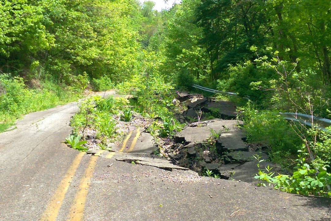
From Logan, we rode for a mile along the top of the ridge, enjoying views of downtown before diving back down toward the Allegheny. Just mind the construction zone where half the road has fallen off the side of the cliff into the woods below…
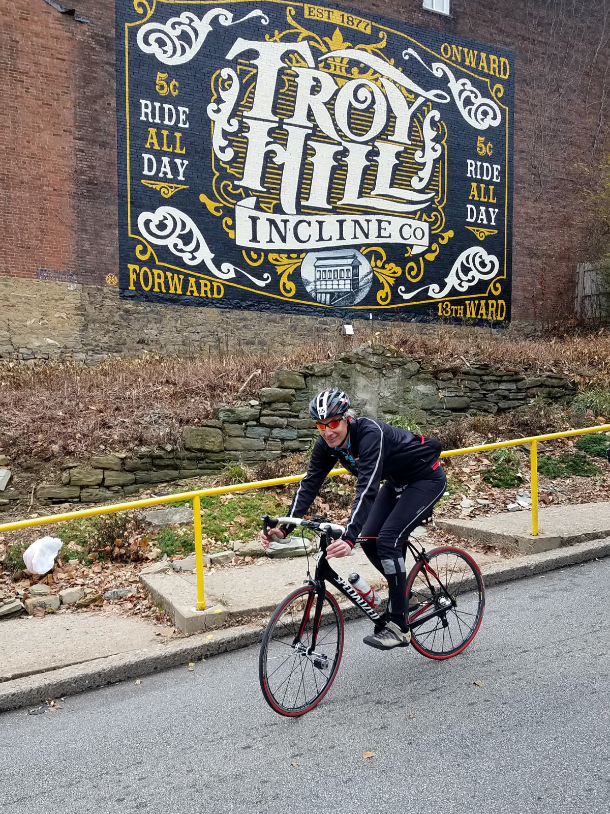
Hill 6: Rialto St
Once upon a time, the pig farmers living at the top of this ridge—called Pig Hill—used to herd their swine through a narrow, muddy path straight down the cliff to the slaughterhouse at the riverside. This being Pittsburgh, they poured some concrete down the hill and called it “Rialto Street”. At some point they built some stairs along the side, too, just to make it even narrower.
Not being satisfied with this ridiculous “street”, they decided to build a five-way traffic light-controlled intersection right at the bottom of this stupendously steep street, controlling both sides of the Route 28 divided highway, the busy 31st Street Bridge over the Allegheny, another road from Herrs Island, and River Ave. It is a complete and utter cluster, and you’d better have good brakes if you go down that hill.
The good news for riders is that Hill 6 is a short, monotonic sprint of a hill. Climb 123 feet up Rialto in about 750 feet (18%), and you’re done before your body even registers the effort. The bad news is that before you can climb it, you have to carefully inch down it, somehow come to a sudden stop at the bottom to avoid getting splattered on the divided highway, then turn around in a tiny space and climb back up the stupidly narrow road from a dead stop, while other riders are still descending toward you.
This was where my partner Inna had chosen to watch the event. I called out to her as I started my descent, and she got some nice footage of me as I powered back up. Although I had no opportunity to stop, it was encouraging and gratifying for her to share in the event by cheering me on.
Although it does take an intense sprint effort, Rialto is one of the easier hills, which is a blessing, sandwiched as it is between two of the most difficult. On the other hand, car traffic makes it difficult to train on it on your own, so I only rode it four times before the event. Although I completed it in just 1:56, that was still my slowest time of the year.
Between hills the riders would chat, and this is as good a place as any to note how many comments I got. Several people asked about my hub-based Nut-R GoPro camera mount; a couple asked about my little Ass Saver clip-on fender; and one asked about my Di2 electronic shifting. Everyone loved the yellow “FALL RISK” wristband that I’d picked up during my mother’s hospitalization, which I’d attached to a loop on my saddle; that was particularly appropriate for a Dirty Dozen rider! And a guy who knew me from group rides observed that I wasn’t wearing my usual Shimano cycling sandals.
Leaving Rialto, we had a mile and a half of descent before hitting East Street, which in turn comprises a half mile of climbing. This is another section where conserving energy is important, because when you make the left onto Suffolk, you’re gonna need every ounce of strength you’ve got left.
Hill 7: Suffolk St, Hazelton St, Burgess St
After dipping beneath I-279, there’s a sharp, steep climb back up the other side. As the road curves around to the right, you expect the slope to level off, but it never does. It just keeps going, and then gets even steeper. A quarter mile later you see the top of Suffolk and claw your way up to a flat that looks like the top of the hill.
But that’s only the first section, and just when you think you’ve crested the hill, you’re immediately faced with another viciously steep ramp on Hazelton that you somehow have to power up. If you make it up that, there’s still a left turn onto Burgess, which isn’t as steep, but it makes up for it by being paved in granite setts, aka Belgian block, which most people wrongly call “cobblestones”. Altogether the three sections of Suffolk/Hazelton/Burgess are 0.4 miles and gain 358 feet (16% average).
For me, Hill 7 is the hardest of all the hills. It’s long, it’s steep, there’s nowhere to ease off and recover, and before it ends it hits you with the demoralizing wall on Hazelton and the Belgian block on Burgess. It’s a hard, long, intense challenge that will take everything you’ve got, and then some. Like Logan, I also rode it four times in training.
I was wary of Suffolk because on my ill-fated final training ride, I had been taken out by another rider on the lower section coming up from underneath I-279. So for the event, I took a wide line around that corner and was glad I did when I saw two riders come together and fall, stopping two more riders, in exactly the same place I’d been taken out two weeks before.
I nursed my way up to the top of Suffolk, dodging the spectators, weaving riders, walking riders, and riders sitting on the roadside with leg cramps. When I reached the flat bit between Suffolk and Hazelton, I used all the room I could to soft-pedal and rest, nearly getting walked into by a pair of oblivious spectators.
Attacking the narrow ramp on Hazelton, I trailed another weaving rider who just happened to swerve out of my way as I got onto the setts of Burgess, then bounced my way up the rough surface to the top. I finished in 6:37, which is a decent time for me.
I had my thermal jacket partially unzipped to vent the heat from that effort, and the 55° air temperature would work perfectly for me all day. I unzipped my jacket before the hot climbs; enjoyed the cool breeze on the descents, which felt lovely; and zipped it up once I fully cooled off again.
After Suffolk you have lots of time to recover, as the four-mile transfer to the next hill includes a long descent, winds through downtown, and crosses two rivers on two bridges to get from the north side to the south side.
Hill 8: Sycamore St
From the Monongahela riverside, Sycamore climbs straight up Mount Washington to the overlooks on Grandview Ave. Thankfully, Sycamore is another one of the middling-hard hills, rising 296 feet in 0.4 miles (12%). It begins moderately hard, gets a little harder before hitting a cambered switchback. Then it eases off for a quick rest before a final kick that isn’t too difficult.
Four weeks before the Dirty Dozen, Sycamore had been milled, making for a treacherous, gravely ascent during the height of training season. Thankfully, a new surface was laid down a week before the race.
The climb wasn’t bad, but there were a lot of cars trying to get down the hill at the same time. Having stopped to let us pass, many of the occupants were screaming encouragement. There was some runoff water on the road surface in places, which I instinctually avoided, lest I lose traction. I was surprised that there were no spectators near the switchback.
Since it’s easy for me to get to, I had ridden Sycamore eight times in training; three of those while it was milled, and once to check out the new surface. I finished in 7:00, which was a slow time, but faster than when the road had been milled!
A short but painful section of cobbles leads the riders to the Mt. Washington overlook, where a group photo is traditional. I took the opportunity to bleed air pressure from my tires, so that I’d have maximum traction on the upcoming setts of Canton Ave.
The next two hills are three miles away down in Beechview, in Pittsburgh’s south hills. They’re hard to get to for two reasons: first, it requires riding on two extremely busy high-speed arterials; and second, you have to traverse two major hills and valleys to get there.
The second of those intermediate hills—Crane Ave—would qualify as a Dirty Dozen hill in any city other than Pittsburgh. Climbing 263 feet in a half mile (9%), it’s a long, steep climb that inevitably causes tiring riders to whine. It also loads some extra fatigue into your legs: the perfect preparation for the steepest street on the whole damn planet!
Hill 9: Coast Ave, Canton Ave
From the Banksville Road divided arterial, you turn onto Coast Ave, which is the start of Hill 9. Although the entire Coast/Canton hill rises 106 feet in a tenth of a mile (135), you have a gentle 50-foot climb up Coast before the left onto Canton.
Canton is only 200 feet long, but you climb 65 feet in that distance. It’s a full-out 30-second sprint, but you’re at the top before your body has time to react to the effort. From a physiological standpoint it’s one of the easiest hills on the course.
But at 37% grade, Canton is the steepest public street in the world, and it is totally unlike any hill you’ve ever ridden. It’s a special kind of challenge, for many different reasons.
First, it asks whether you have the mental strength to even look at that stupid, obscene hill and not give up. Then there’s the technical challenge of riding something steeper than you’ve ever experienced. If you put your weight too far forward, your back wheel will lose traction, slide out, and you’ll fall; but if your weight is too far back, your front wheel will lift right off the ground and you’ll lose control and fall. And trying to swerve back and forth across the narrow street ain’t gonna help you.
During the Dirty Dozen there are additional complications. You need to make it up amongst lots of other riders, who will be at the limits of their control and likely to fall in front of you or into you. You also need to block out the hundreds of screaming spectators lining the street, drawn by the spectacle of widespread carnage.
But those are just the obvious challenges. Like stalking a lion on safari, Canton is wily and treacherous, and you should not approach it casually.
At the bottom, the road is cambered wildly, so the left side of the street is a dramatically steeper grade than the right. Furthermore, trees and shrubs encroach into the road, blocking the left third of the street. There’s deadfall and moss making the surface very treacherous, and don’t forget the likely complications of November rain and snow and salt, as well.
And then there’s the surface. You start out on nice, sticky asphalt. As the incline begins, it switches to broken concrete, with broad cracks filled with grass or nothing or maybe a pile of leftover asphalt. Then, at the point where the slope requires the most traction, you drop off the concrete surface onto loosely-joined Belgian block setts. You have to somehow lay down maximum power on the steepest slope while bouncing along atop the granite paving stones and hopefully avoiding the occasional holes left by missing stones. Then pull yourself over a thin strip of concrete and back onto some asphalt to crest the hill. So you have to manage four changes of road surface on top of everything else you’re supposedly focusing on.
On the training ride when I first attempted Canton, I started bouncing around and immediately lost traction when the road transitioned from cement to setts. I went back down and dropped about 20 PSI of air from my tires to get better traction, then decided to take it easy until I had gotten firmly onto the Belgian blocks before putting down maximum power; those two changes seem to have unlocked the hill for me. But heading into the race, I had only ridden it two times in my life.
Coming up Banksville just prior to 2pm, I chatted with Phil, which completely distracted me from thinking about all those things I should have been worrying about. Once I turned onto Coast and soft-pedaled to fall well behind the rest of the field, I could hear the band and screaming crowd who had come out to watch the spectacle.
Since there is no such thing as momentum on a hill that steep, I slowly approached the turn, only looking up long enough to register that my way wouldn’t be clogged with fallen bodies or riders walking their bikes up or down the hill (the video actually shows I would thread the needle between three of them). Then I looked straight down at the road in front of me, blocked out absolutely everything going on around me, rolled slowly over the edge of the cement surface onto the Belgian block, and gunned the living hell out of it.
Not thinking about anything but laying down power, I tracked arrow-straight right up the hill, bouncing around but managing to keep traction and forward progress. And in 30 seconds it was done, and I was looking for a place to park the bike.
My time was 2:47, but like everything else, times on Canton aren’t what they seem. Most of that was spent pussyfooting my way up Coast, saving my strength and letting the carnage play out for the rest of the group in front of me before my rabid sprint to the top.
Since I blocked everything out of my mind, it was nice to find some video footage so that I could later hear the cheering and look at what was going on around me while I was locked on: in the Canton Zone. Someone got a nice still of me, and I appear in this video at 2:43 and this video at 10:50. And then there’s my own on-bike POV video…
Since we’re often at the top of Canton for some time as people who fail to crest the hill the first time try again (and again), that’s also where the race’s second rest stop is located. I took on a banana and Gatorade, and put some air back into my rear tire to handle the mere 30% grades remaining.
After a 15-minute break, we set off for Hill 10. Along the way, a kid tried to race me up the steep hill behind Canton. I let him go, saying, “I’d race ya, but I’ve got four more hills to ride!”
Hill 10: Wenzell Ave, Boustead St
People are usually elated after Canton. They’ve beat nine hills, including the steepest one of all. It’s all “downhill” from here, right?
No, no it isn’t. There’s a lot of difficult riding still ahead, starting just three blocks later, when you are smacked in the face by Boustead, which is nearly as steep as Canton, but longer, and you get a nice long view of the ridiculous wall ahead of you.
There’s a moderately steep (80 feet in a tenth of a mile) climb up Wenzell before the turn onto Boustead, which has a little dip in it before it launches skyward, climbing another 120 feet in a tenth of a mile. The Wenzell/Boustead combo is 220 feet in 0.3 miles (12% average). But it gets viciously steepest right at the top. Like Canton, I had only ridden Boustead twice in training.
On my final training ride, I’d cleared Boustead, but it had cost me, and after that I hadn’t had the strength to complete two of the three hills that remained. So Boustead was the hill I was most afraid of coming into the race. I was concerned about whether I would be strong enough to get over it, and if I did, would I have anything left in the legs for the three hills after that?
The wily old veterans Phil and I hung back before hitting the hill ourselves. Halfway up, I found myself having to swerve back and forth across the road to make it up, but at least I knew I wasn’t interfering with anyone behind me! At it steepest, when I was about to bust, I pulled out all the stops in a full-bore sprint, which somehow got me far enough over the crest to crawl toward the line. It was deathly hard, even at my slowest time of the year (5:58).
After commiserating with the others at the top, we had another four-mile ride back up to the south side, along those busy arterials and back over two climbs that were very meaningful (to the legs) but utterly meaningless (in race terms). That included descending P.J. McArdle, which was surprisingly free of runoff water from the hillside above, which usually makes it very dangerous.
Hill 11: Welsh Way
Welsh Way is a clone of Rialto: same monotonic incline, same narrowness, same shortness; the only differences are that there’s no divided highway at the bottom to contend with, and you go up it first, then have to come right back down again, because it’s a dead-end street.
For my money, Welsh is the easiest of the Dirty Dozen hills. It’s manageably steep, 123 feet of climbing, and only 800 feet long (11%). And it’s the last easy hill amongst the satanic hills that precede and follow it. Though on these narrow ones you do have to watch out for other riders, especially out-and-back streets like Rialto and Welsh, where riders are going up/down while you’re going down/up.
Along with Sycamore (Hill 8), hills 11-13 are all close to home, so I’ve done them many times in training. For Welsh, that came to nine ascents.
Hill 11 was an opportunity for me to take it slow and easy as I kept my distance from other riders. My 3:11 time was on the slow side, but what surprised me was the number of riders who were cramping up, or that had to stop and walk the hill: the easiest hill of them all!
At the top, the group took a long, unexpected 10-minute rest; I was thankful for the recovery time, because I was dreading Hill 12. After coming back down Welsh Way, there’s a little more than a mile before you get to the next climb: the one most cyclists fear more than any other.
Hill 12: Barry St, Holt St, Eleanor St
And here we have it: the last truly vindictive hill. Many people think Eleanor is harder than Suffolk; I disagree, because Hill 12 does offer riders a precious mid-climb rest, but I can definitely see where they’re coming from. Barry/Holt/Eleanor climbs 343 feet over 0.4 miles at 15%. If it’s not the hardest, it’s the next one on the list, and by this point your legs are completely used-up.
Riding along the flat of Josephine Street, Barry is a sudden switchback up and to the right. You climb up to a 90-degree turn, which reveals a hard drag leading up to a steeper ramp in the distance. This is another one where you have to save your strength for the end.
That distant ramp is a one-way the wrong way, but we go up it anyways. After two tenths of a mile and 150 feet of climbing, you turn 90 degrees into Holt St, leveling off quickly for a very short breather, followed by tiny second kick, then a longer breather as you soft-pedal on the blessedly well-placed flat bit of Holt. Milk it for every picosecond of recovery you can, because…
Then you’ll see riders turning left onto Eleanor St and climbing at an unbelievable angle. You hit it and are faced with a long, steep slope: 25% grade, or 130 feet over a little more than a tenth of a mile. It’s a slow drag for several blocks and it just keeps getting steeper the farther you go. Finally the road bears right and you fight your way gasping over the final—even steeper!—rise to the line. Like Welsh, I’d ridden Eleanor nine times before the race.
I was noticeably much slower than normal up Barry. I barely managed the ramp between Barry and Holt, only to be pinched with two other riders in a two-foot space between a guardrail and a line of cars waiting to come down.
While I soft-pedaled as slowly as possible on the flat, one rider asked if we had finished the hill, and several riders passed me before they realized they still had the entire painful length of Eleanor to go. And therein is the best demonstration why you scout these hills before the race.
Even with my precious extra picoseconds of rest, Eleanor was a hard, long, painful death march. The three riders just in front of me were swerving wildly in slow-motion back and forth across the narrow road, but I watched gratefully as every one of them gave up and veered off onto the flat side-streets a mere third of the way up.
I heard “Ride of the Valkyries” played inexpertly on trumpet up ahead, and the cheers of a boisterous crowd of spectators. Just like on Boustead, on the vicious final kick near the top—where I’d dabbed on my last training ride—I reached the end of my strength, but somehow dug deeper and managed a leg-searing low-speed “sprint” over the top. My 7:34 was—can you guess?—my slowest time of the year. You can see my progress near the top in photos one, two, and three.
The neighborhood—bless them, including the trumpeter!—have a big party and rest stop in a garage on Cobden St, at the top of Eleanor. Between that celebration, waiting for the slower riders, and recovering before setting off for the final hill, there’s always a happy little extra time to rest here. Just one hill left; what a wonderful thought! If I rest up here, and take it easy on the approach, I might just be able to make it up the horrible final climb…
After 15 minutes, we set off on the long 4-mile transfer, ripping down the Josephine descent, over the Hot Metal Bridge across the Monongahela, then down Irvine Street to Hazelwood. Along the way, ride marshal Jason reminded people of the after-party taking place at a local brewery… and that the celebration had officially started 49 minutes ago!
Hill 13: Flowers Ave, Kilbourne St, Tesla St
Way too soon for my legs—but not too soon for my shadow!—we took a left turn off the main drag onto Flowers Ave, where the ride’s longest hill begins. However, it starts out perfectly flat, becomes a false flat, then a turn onto a slightly steeper—but still easy—ramp. A turn onto Kilbourne: another long climb that—at about 15% grade—doesn’t warrant the term “steep”.
That long lead-up is just there to soften you up. Kilbourne ends at a flat spot where you can gather your breath before the final sprint. At this point you’ve climbed 280 feet over three-quarters of a mile. Turning onto Tesla reveals another short but intimidatingly steep wall that is all that stands between you and the finish line.
Although it’s by far the longest, people don’t put Hill 13 on their list of the hardest climbs. It’s not that bad until the end, but it’s a hard battle getting up the punishingly steep final slope, especially with the residue of 12 other ludicrous climbs already weighing down the legs. It’s another 140 feet of climbing, jammed into a little more than a tenth of a mile. The flat sections make it misleading, but the entirety of Flowers/Kilbourne/Tesla is 430 feet of climbing over 0.9 miles (9% average).
But eventually it tops out in a tiny neighborhood: six houses sandwiched between a cemetery and a huge water storage tank. And, thankfully, the finish line.
As I turned onto the flat part of Flowers, I passed three riders stopped off the road, cramping: cramping on the flat! That wasn’t the only time I was grateful to have ridden 75 Dirty Dozen hills in training!
Tesla is my “local” hill, so I’m very familiar with it. Having done Hill 13 a dozen times in the past two months, I took my time on the preliminary slopes of Flowers and Kilbourne. Then I did everything I could to recover, slow-biking on the flat spot at the top of Kilbourne. I didn’t have any strength left for the final ramp up Tesla, but it had to be done, and it was all that stood between me and my goal of being an official Dirty Dozen finisher… And more importantly, putting an end to this long day’s interminable pain and suffering!
I hit the base of the hill with everything I had, which was damned little. I don’t know how I made it even halfway up. When the slope reached its most punishing, I tried to pull out the stops and sprint over the crest, but there just wasn’t any more strength to call on. But somehow I clawed my way over the magical point where the grade lowers just a little, then crawled up the remaining slope toward the water tower just ahead.
A spectator ran right up to the rider in front of me and made noises and hand gestures like he was revving a motorcycle engine. I think that was supposed to be encouraging. Then a kid came up to that rider and handed him… a blue ribbon? A *finisher’s* ribbon!!! I rolled slowly toward him and claimed one for myself: “Pittsburgh Pennsylvania; 2017 DIRTY DOZEN; FINISHER!” (the righteous caps and exclamation point are theirs).
Finish
With my blue ribbon clutched in my teeth, I coasted through the small crowd and off to the side and panted for a while, recovering and trying to sort out my feelings.
I was filled with an incredible sense of accomplishment and satisfaction. I’d surpassed all the goals I’d set for myself: I had enormous fun, learned a ton (which you’ll see below), and successfully finished the entire event without crashing, stopping, or dabbing. In this later stage of a long life that’s been filled with lots and lots of cool shit, finishing the Dirty Dozen ranks as Certified Cool Shit.
After catching my breath, I went over and chatted briefly with my buddy Mike, who had also ridden in Group 3, and got him to take a picture for me. I think it’s a perfect representation of the moment. It’s clear that I’m exhausted, but also really, really happy, and you won’t find another picture of me with a more genuine smile.
However, my fellow riders were dispersing, many headed toward the after-party. Few people were hanging around, since that neighborhood doesn’t like our presence. It was 4:15pm and time for me to go home.
Epilogue
Thankfully, home is only two miles from Hill 13, with much of it flat or downhill before a shallow climb to the apartment. Along the way, my odo ticked over 50 miles for the day. I pulled into our driveway 8 hours and 15 minutes after leaving, having climbed 5,971 feet, well more than a vertical mile.
After having been preoccupied and anxious leading up to the event, it was wonderful to have it over and done with. I piled up a plate of leftover turkey and observed a heartfelt Thanksgiving meal. It was only then that I understood the real meaning of Thanksgiving: not having to even consider riding any of those verdammten Dirty Dozen hills for six months or more!
Although I’d proclaimed this would be my toughest challenge, going by feet per mile of ascent it was number four, and Strava’s “suffer score” feature, which measures heart rate and duration, lists it as number 51. My preparation helped me go into the event strong. I was lucky and a little wily in managing to avoid any crashes and falls, and you couldn’t have asked for better weather. There’s no guarantee that the experience would be similar in the future, or for anyone else, but for me it was a damned fine day all around.
Will I do it again? That’s impossible to say. At my age, it requires a lot of dedicated training, and willingness to ride in inclement conditions. I’ll surely do those hills again from time to time, and maybe some of the group training rides, which were fun. But the full event is an immense undertaking, and I’m not sure whether it’s something I want to commit so heavily to. We’ll see.
For now, I’m completely happy and satisfied to have completed it once.
Strategies to Beat the Dirty Dozen
When I was preparing for my first Dirty Dozen, I looked all over the place for advice, hints, and tips. So I want to offer this distilled advice to other cyclists considering this event.
Here are several of the things I learned. All this preparation and training might not be easy, but in my opinion this is how to beat the Dirty Dozen and have a good time doing it.
The most obvious first step is to know what you’re up against. Don’t go into the event unprepared; this isn’t an event you want to take lightly, unless you’re someone with a deep affinity for failure.
Pre-ride all the hills at least a couple times, so that you intuitively know when you need to give 100%, and—more importantly—where you can rest and let your legs recover. You can recover a lot of muscle power by backing off for just a few seconds. Use the organized training rides to learn valuable pointers from the veterans who have done it before.
Second, prepare your body. Climbing is all about your power-to-weight ratio. Maximize your power by training for the effort you have to put out. Build up the necessary strength over time by riding those hills. The full-course group ride two weeks before the race is valuable for getting your body used to doing not just 4-6 hills, but all thirteen. At the same time, make it easier on yourself by losing any extra weight you’re carrying.
Unless you’re racing, your only goal is not to dab; don’t worry about your time or speed, because no one cares about your finish time. Knowing how to pace yourself and conserve your strength is the most important thing to learn. That means saving your strength for the worst part of any given hill, but also conserving your energy over the duration of the entire course. Even knowing how long and how hilly the neutral sections are can be a valuable way to manage your effort and recovery.
Know what your equipment needs are. How low of a set of gears do you need to make it through the day? What tires—and what tire pressures—will give you enough traction to make the hills? What clothing are you going to need in order to endure the alternating max efforts, freezing descents, and lots of standing around in the cold? What can you take off your bike in order to make it lighter?
I ran a low gear of 34x28 (32 gear-inches), which is a moderately easy gear for a standard compact chainset. I would have run a larger cassette—a 30 or 32—but my older Ultegra Di2 won’t take anything bigger than a 28. On the other hand, the electronic system produced much more reliable shifting under load than a mechanical groupset.
Then there’s climbing technique. Most riders know that you use much less energy seated than when you get out of the saddle and stand to power over a rise. But with hills this steep and long, you need to be able to alternate between both techniques to balance muscle fatigue, even at extreme slopes. Pulling up on the handlebars helps, but your biceps can wind up cramping. And as I said in the section on Canton Ave the steepest slopes require a mastery of balance. You need to know where your balance point is, especially on wet Belgian block at a 37% incline.
Though your strength and equipment and technique will always be secondary to external conditions. These steep roads don’t get much maintenance, so they have potholes, broken-up surfaces, can be off-camber, or even paved with granite setts. You might encounter loose gravel, sand, or salt spread across the road, or spots made slick by snow, ice, wet leaves, or just leaked automotive fluids. And sometimes your way can be blocked by cars or something else completely out of your control.
Now take all of that, and try to do it amidst 400 riders of mixed ability, all riding at different paces, many of them completely unprepared for the conditions. In that situation, your biggest threat comes from other riders weaving in front of you, dropping their chains, falling into you, or blocking you and forcing you to stop. While you’re fighting the hill and the road surface, you have to watch for dangerous riders.
Finally, you need to be psychologically prepared. The best advice I have here is to explicitly not psych yourself up; treat the event as if it were just another fun weekend out. Take all the stress and pressure out of it, and you’ll be better able to deal with whatever comes up.
As for dealing with the pain and suffering… I’m sorry, but that’s what you signed up for. You have to welcome the worst the course can throw at you. Think about the bragging rights you’ll gain and the stories you’ll have!
Finally, enjoy the camaraderie of your friends and fellow Dirty Dozen riders, as well as the spectators’ encouragement and awe. Whether you finish the course or wind up walking several of the hills, have fun, because if there’s one phrase that captures the essence of the Dirty Dozen, it’s “ridiculous fun!”


 Taking it outside for a quick test ride, the first thing that happened was that the frame pump fell off, which I fixed by putting it on properly, as it hadn’t been before. Then, as I worked my way through the gears, I felt a sudden jerk and nearly fell because my pants had gotten caught in the chainring and torn. I’d been dumb enough to do the test ride still wearing my jeans—a stupid move to begin with—and it ripped a seven-inch tear right up the pantleg. I had to hobble back to the shop holding my pantleg up. I also had them decrease the float on the pedals.
 Then I drove back through Hood River to the Pine Grove School at the foot of Van Horn Butte, where I began
  The first hint of a problem came from my GPS, which seemed to be getting confused between waypoints I’d set for the outbound leg versus those on my return. I wouldn’t figure out until later that I’d missed a turn from Lost Lake Road onto an unmarked forest service road and had actually jumped from my planned outbound route to the road I’d planned to return on!
 Once home, I had a couple surprises in the mail. One was a